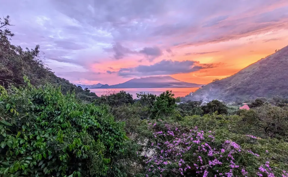
A lake made by an eruption
Roughly 80,000 to 85,000 years ago (sources give slightly different dates), one of the largest volcanic eruptions of the last 100,000 years blew apart a volcano here. It is called the Los Chocoyos eruption. Ash fell across millions of square kilometers. With the magma gone, the ground collapsed into a vast bowl, and over time water filled it.
That bowl is the lake. It reaches about 340 meters deep, the deepest in Central America, and it has no outlet to the sea. Rain and rivers feed it, so its level rises and falls with the years. Three younger volcanoes grew up inside and beside the old crater. San Pedro is the oldest and went quiet around 40,000 years ago. Atitlán is young and still active, with its last eruption in 1853. Tolimán completes the trio.
The name Atitlán comes from Nahuatl and is usually translated as "at the water" or "between the waters."
The people of the lake
People have lived here for thousands of years. Today the lake is shared mainly by two Maya peoples. The Kaqchikel live along the north and east shores. The Tz'utujil live along the south and west, in towns such as Santiago Atitlán, San Pedro and San Juan. Above the lake, in Santa Clara, the K'iche' language is spoken.
Before the Spanish arrived, the Tz'utujil capital was a hill town called Chiya', meaning "at the water," and known today as Chuitinamit. Its ruins sit across a narrow inlet from Santiago. The Tz'utujil and Kaqchikel competed for land and power around the lake, and the Kaqchikel held part of it.
The lake held sacred places as well. In 1996 a local diver, Roberto Samayoa, found Samabaj: a ceremonial site on what was once an island, now underwater. It is roughly 1,700 to 2,000 years old, with carved stone monuments still standing. Archaeologists think rising water drowned it. Its exact location is kept secret to protect it from looters. In Panajachel, the Museo Lacustre tells its story.
Even the name of our village carries this history. Tzununá comes from Kaqchikel and is often translated as "hummingbird of the water."
Conquest and the colonial years
In 1524, the Spanish conquistador Pedro de Alvarado reached the lake. He took advantage of old rivalries, and the Kaqchikel joined him against the Tz'utujil. The Spanish won, and the Tz'utujil lost land and control of the lake.
In 1547 the Spanish gathered scattered communities into towns. That pattern of lake municipalities still shapes the villages you visit. Franciscan friars moved the Tz'utujil center to Santiago and built a monastery there.
Later centuries took more. Coffee and other plantations claimed much of the best land, and many families ended up working for others, often in debt. Even so, language, weaving and ceremony survived. In Santiago, San Antonio Palopó and Sololá, many men still wear traditional dress, and Maya and Catholic traditions are woven together. Maximón, in Santiago, is one of the best-known examples.
Hippies, then war
The lake became a national park in 1955, and Guatemala looked for ways to attract visitors. In the 1960s and 1970s, Panajachel became a stop on the international hippie trail. Some visitors stayed, and some villages grew around them. Many in that spiritual tradition have since moved to San Marcos and San Pedro.
Then came the Guatemalan civil war, which ran from 1960 to 1996. By the early 1980s, the violence had reached the lake. In 1981, the American priest Stanley Rother was murdered in Santiago, and others were killed in the area that year. On December 2, 1990, soldiers fired on an unarmed crowd in Santiago that had gathered to protest abuses by the army. About 14 people were reported killed. The town's response was swift and organized: thousands signed a petition within a day, and within two weeks the army left its base. Santiago became one of the few large Guatemalan towns without a military base. Many families here still carry those memories. If you visit Santiago, do so with humility.
Tourism fell during the war years and returned after the peace agreements.
The lake today
The lake is living and under pressure. After the park was created, predatory bass were introduced. They wiped out more than two-thirds of the lake's native fish and helped drive a rare bird, the Atitlán grebe, to extinction. In 2009, a large bloom of cyanobacteria (blue-green algae) spread across the lake, fed by sewage, farm runoff and deforestation. Another strong bloom followed in August 2015. More than 100,000 people rely on the lake, so this matters. The lake authority advises against drinking its water or eating its fish.
Recent years have also brought rising water that flooded shoreline houses and docks. Many Maya villages sit high above the shore, and they have long known the lake's moods.
Visitors can help a little. Carry a refillable bottle. Use businesses that treat their wastewater. Buy directly from Maya artisans and cooperatives. Ask before photographing anyone. The chapters on culture and ceremony in this guide cover the rest.
A note from us
We are guests here. This page is a summary from published sources, not the lake's own telling. We hope you will listen to people who live here.
Sources
- Wikipedia: Lake Atitlán; Tz'utujil people; San Juan La Laguna; Panajachel
- Cultural Survival: "Massacre in Santiago Atitlán: A turning point in the Maya struggle?"
- NASA Earth Observatory: "Harmful Bloom in Lake Atitlán, Guatemala" (2009)
- Global Press Journal: contamination of Lake Atitlán (2015 bloom)
- NBC News and Prensa Libre on Samabaj; Revue Magazine on the Museo Lacustre
- Rough Guides: Lago de Atitlán; Frommer's: Panajachel
- Routinely Nomadic: Tzununá guide